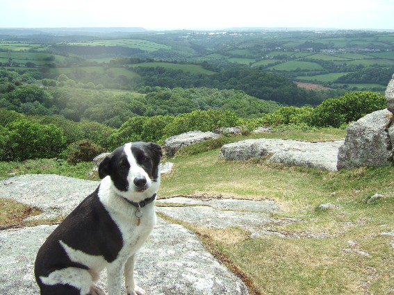
Start Point; Shipley Bridge
Distance 11 miles
Time 4 hrs 45 mins
Guiness enjoyment rating 8/10
We're back. This walk starts at Shipley Bridge, east of South Brent and follows a road toward Avon Dam Reservoir.
After all the recent dry spell I was expecting the Reservoir to be half empty but was pleasantly surprised that it was half full, slightly less after Guiness had a mouthful.
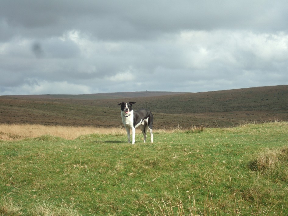
This photo - toward Pupers Hill is about 4 miles later after an eastward turn along Abbots Way and then a short road section via Cross Furzes.
The origins of this circular stone section are unknown, at least to me.
The final stretch is along an old Dismantled Tramway. I wasn't entirely sure I was going in the right direction, but Guiness seemed to know the way. A longer walk that I was planning but Guiness had no complaints.
Friday, 20 May 2011
Sunday, 15 May 2011
Cadover Bridge
Start Point; Cadover Bridge (River Plym, 2 miles sw of Yelverton)
Distance 7 miles
Time 3 miles
Guiness enjoyment rating 8/10
A venture to the Southwestern side of the moor, this walk starts from Cadover Bridge...
and heads west thought lovely North Wood
We then headed to a viaduct where some people were risking life and limb abseiling for charity.
A stray wolf made a brief appearance.
Heading north we soon came to a tunnel. Guiness was naturally wary as he'd heard of the bright eyed monster that hid within. I found it really dark inside but being the clever thing I am I worked out (eventually) that I could improve this by taking off my sunglasses.
After heading east through we then climbed to Dewerstone Rock where Guiness insisted on posing for the camera.
And then it was a leisurely stroll across Wigford Down and back to the car.
Distance 7 miles
Time 3 miles
Guiness enjoyment rating 8/10
A venture to the Southwestern side of the moor, this walk starts from Cadover Bridge...
and heads west thought lovely North Wood
We then headed to a viaduct where some people were risking life and limb abseiling for charity.
A stray wolf made a brief appearance.
Heading north we soon came to a tunnel. Guiness was naturally wary as he'd heard of the bright eyed monster that hid within. I found it really dark inside but being the clever thing I am I worked out (eventually) that I could improve this by taking off my sunglasses.
After heading east through we then climbed to Dewerstone Rock where Guiness insisted on posing for the camera.
And then it was a leisurely stroll across Wigford Down and back to the car.
Friday, 22 April 2011
Short loop form Bennett's Cross
Start Point; Bennett's Cross (on B3212, 2 miles from Postbridge)
Distance 5.5 miles
Time 2.hrs 15 mins
Guiness enjoyment rating 7/10
A little tiddler to start another season of walks on dartmoor with Guiness. I choose not to walk on Dartmoor during winter; personal safety and welfare are improtant to me and in winter there is a hightened chance I might get wet.
This walk starts from Bennett's Cross and starts along the Two Moors Way before almost immediately veering south to Headland Warren Farm.
It then follows a path to 'the medieval village of Challacombe'...
before looping around and arriving back at the start via Soussons Down. NIce little walk.
Distance 5.5 miles
Time 2.hrs 15 mins
Guiness enjoyment rating 7/10
A little tiddler to start another season of walks on dartmoor with Guiness. I choose not to walk on Dartmoor during winter; personal safety and welfare are improtant to me and in winter there is a hightened chance I might get wet.
This walk starts from Bennett's Cross and starts along the Two Moors Way before almost immediately veering south to Headland Warren Farm.
It then follows a path to 'the medieval village of Challacombe'...
before looping around and arriving back at the start via Soussons Down. NIce little walk.
Saturday, 27 November 2010
Okehampton and Belstone
Start Point; Okehampton
Distance 9 miles
Time 3.hrs 30 mins
Guiness enjoyment rating 9/10
My favourite walk on Dartmoor! Have done this 4 times now- it has everything; riverside woodland sections, rolling farmlands and a section of wild open moorland which is Dartmoor at its best. The snows had fallen overnight and I knew it would look stunning today and indeed it did.
The walk starts at Okehampton...
and follows the river near the castle...
before we fork right to take an uphill section through woodland to the road that leads to the moor.
At the top of the climb we veer left for a stretch on private road where Guin enjoyed a play with his ball...
Next to an isolated farm which acts as an entrance to the wild moorland section of the walk. Loads of Shetland ponies about today. The views here were, as Bernard Mathews would have said had he not died yesterday, bootiful.
This section of the walks link up with South Tawton Common that we did back in June. At the most isolate section today the mists descended but was I worried? What me, experienced moorman that I am?
The pathway here leads back to Belstone.
Across farmland finds you at the final stretch along the river at East Okement (when it started snowing) before arriving back in Okehampton.
Distance 9 miles
Time 3.hrs 30 mins
Guiness enjoyment rating 9/10
My favourite walk on Dartmoor! Have done this 4 times now- it has everything; riverside woodland sections, rolling farmlands and a section of wild open moorland which is Dartmoor at its best. The snows had fallen overnight and I knew it would look stunning today and indeed it did.
The walk starts at Okehampton...
and follows the river near the castle...
before we fork right to take an uphill section through woodland to the road that leads to the moor.
At the top of the climb we veer left for a stretch on private road where Guin enjoyed a play with his ball...
Next to an isolated farm which acts as an entrance to the wild moorland section of the walk. Loads of Shetland ponies about today. The views here were, as Bernard Mathews would have said had he not died yesterday, bootiful.
This section of the walks link up with South Tawton Common that we did back in June. At the most isolate section today the mists descended but was I worried? What me, experienced moorman that I am?
The pathway here leads back to Belstone.
Across farmland finds you at the final stretch along the river at East Okement (when it started snowing) before arriving back in Okehampton.
Monday, 22 November 2010
Lustleigh Cleave
Start Point; Lustleigh
Distance 6 miles
Time 2.hrs 30 mins
Guiness enjoyment rating 8/10
A common walk for 'newbies' to the moor. Very easy to follow and suitable all year round, this walk is quite delightful, though hard going at times, especially at the start as you climb for a mile or so.
There is a lovely view at the top and a sturdy boulder to sit upon for a bite to eat.
There then follows an open moorland section to Hunter's Tor...
...before farmland down to a farm. This is the turnaround point before the final stretch back through the wooded Bovey Valley and back to Lustleigh
<iframe width='465' height='548' frameborder='0' src='http://connect.garmin.com:80/activity/embed/57574259'>iframe>
Distance 6 miles
Time 2.hrs 30 mins
Guiness enjoyment rating 8/10
A common walk for 'newbies' to the moor. Very easy to follow and suitable all year round, this walk is quite delightful, though hard going at times, especially at the start as you climb for a mile or so.
There is a lovely view at the top and a sturdy boulder to sit upon for a bite to eat.
There then follows an open moorland section to Hunter's Tor...
...before farmland down to a farm. This is the turnaround point before the final stretch back through the wooded Bovey Valley and back to Lustleigh
Thursday, 7 October 2010
Ugborough Moor
Start Point; Harford Moor Gate Car Park
Distance 6 miles
Time 2.hrs 45 mins
Guiness enjoyment rating 7/10
A remote start to this one, just north of Ivyridge at Harford.
We headed east along a track...
Soon we joined up with the Two Moors way and headed north...
with Ugborough Moor in the background...
Veering north takes you up a climb to the 'Three Burrows'
Decision to make, should I return along the same track or head down to the river?
...choose the river route..(The Erme)
back through Piles Copse
a pic of Guin to end.
Distance 6 miles
Time 2.hrs 45 mins
Guiness enjoyment rating 7/10
A remote start to this one, just north of Ivyridge at Harford.
We headed east along a track...
Soon we joined up with the Two Moors way and headed north...
with Ugborough Moor in the background...
Veering north takes you up a climb to the 'Three Burrows'
Decision to make, should I return along the same track or head down to the river?
...choose the river route..(The Erme)
back through Piles Copse
a pic of Guin to end.
Saturday, 2 October 2010
Widecombe in the Moor
Start Point Widecombe in the Moor
Distance 10.5 miles
Time 4.5 hours
Guiness Enjoyment rating 9
The walk starts at Widecombe in the Moor. In the height of summer there can be dozens of tourists enjoying the tea rooms and gift shops but today scarely a soul to be seen.
Its an arduous climb for the first half a mile but worth it for the views back over witm.
The stretch of walking is one of of my (and Guiness's) faves on the whole moor - long, flat, dry and excellent ball throwing territory.
It eventually takes you passed 'Grimspound' and Hookney Tor before you veer north easterly through the heathers to reach West Combe. Heading south through farmland you'll reach Heathercombe Woods and a delightful cottage.
After the woods is an excellent spot for a picnic at Natsworthy. As I walked through the woods toward Natsworthy I said a prayer to the almighty that the clouds would miraculously vanish to give me wall to wall blue skies whilst I had my lunch. And they did and here's the evidence. Where are those non believers now eh?
The rest of the walk is mainly on roads but take a detour to scrape by Honeybag and Chinkwell Tors before reaching Bonehill Rocks.
From here just a short stroll down the lane to the start.
Distance 10.5 miles
Time 4.5 hours
Guiness Enjoyment rating 9
The walk starts at Widecombe in the Moor. In the height of summer there can be dozens of tourists enjoying the tea rooms and gift shops but today scarely a soul to be seen.
Its an arduous climb for the first half a mile but worth it for the views back over witm.
The stretch of walking is one of of my (and Guiness's) faves on the whole moor - long, flat, dry and excellent ball throwing territory.
It eventually takes you passed 'Grimspound' and Hookney Tor before you veer north easterly through the heathers to reach West Combe. Heading south through farmland you'll reach Heathercombe Woods and a delightful cottage.
After the woods is an excellent spot for a picnic at Natsworthy. As I walked through the woods toward Natsworthy I said a prayer to the almighty that the clouds would miraculously vanish to give me wall to wall blue skies whilst I had my lunch. And they did and here's the evidence. Where are those non believers now eh?
The rest of the walk is mainly on roads but take a detour to scrape by Honeybag and Chinkwell Tors before reaching Bonehill Rocks.
From here just a short stroll down the lane to the start.
Subscribe to:
Posts (Atom)